OC Loop


What is the OC Loop?
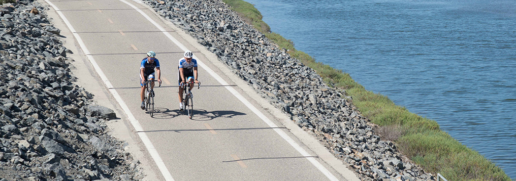
The Orange County (OC) Loop is a vision for 66 miles of seamless connections and an opportunity for people to bike, walk, and connect to some of California’s most scenic beaches and inland reaches. About 88% of the OC Loop is already in place and is used by thousands of people. Currently, nearly 58 miles use existing off-street trails along the San Gabriel River, Coyote Creek, Santa Ana River, and the Coastal/Beach Trail.
Project Map
Project Updates
Completed Segments
The following four OC Loop segments have been completed since creation of the OC Loop vision in 2012:
-
Segment C – Completed by the City of Brea in 2018
-
Segment F – Completed by the County of Orange in 2017
-
Segment H – Completed by the County of Orange in 2021
-
Segment K – Completed by the City of Huntington Beach in 2015
-
Segment R – Completed by the County of Orange in 2014
Continued Progress
Work continues to advance the remaining OC Loop segments:
-
Segments A & B – Negotiations are underway with Union Pacific Railroad to secure a permanent easement in the Cities of La Habra and Brea. These cities have completed an environmental review of these segments and are working on design and securing funding for right-of-way acquisition and construction.
-
Segment D – The County of Orange has completed the final design for the project and is currently in the Bid and Award phase.
-
Segment L – Caltrans will be completing a planning study which will inform the subsequent phases of the project
-
Segment M – There are no current activities being undertaken at this time.
-
Segments O, P, & Q – The County of Orange is currently working on developing the design for Segments O,P, and Q. Anticipated design completion is late 2025.
-
Segment T – Caltrans will be completing a planning study which will inform the subsequent phases of the project.
Benefits
Improved Quality of Life
OC Loop improved quality of life imageA major factor in improving quality of life is access to recreational opportunities and the ability to bike and walk in your neighborhood. The OC Loop serves about 650,000 Orange County residents and thousands of visitors every year seeking refuge from the traffic and noise of urban life. The OC Loop allows people to connect with their environment and see parts of Orange County that most people in their cars don’t often notice.
Expanded Transportation Options
The OC Loop provides convenient paths to some of the area’s most popular destinations. It provides first and last mile connections to numerous bus stops and three Metrolink stations. The OC Loop is also another option for residents and visitors to visit local parks, beaches, schools and shopping areas without worrying about traffic and parking. With minimal stops and crossings, the OC Loop is also a viable commuting route to the many major employers in the area.
Safer Journey to Serve Ages 8 to 80
Paths along the OC Loop attract and serve users of all ages and skill levels. The vast majority of people do not feel safe bicycling and walking on streets with high-speed car traffic. The OC Loop provides a low-stress bicycling and walking route that is suitable for people of all ages!
Stretching the Dollar
Completing the OC Loop would turn underutilized, abandoned space along rivers and railroad right of way into a community amenity. Studies across the country have shown that trail projects are associated with the growth of property values, increased retail spending, improved tax bases and attraction of new businesses. Within Orange County, the return in benefits to health, mobility, recreation and safety can be expected to exceed the cost of completing the OC Loop.
Resources
OC Loops Virtual Workshop – 3/24/2022
On March 24, 2022, OCTA hosted a virtual workshop providing updates on the Gap Closure Feasibility Study. Please see below for information on the project partners and background, project goals, input from participants and next steps.
The Tracks at Brea Trail
The City of Brea completed the "Tracks at Brea Trail" project (OC Loop Segment C) with a grand opening ceremony on May 5th, 2018! See the City website and go visit the newly minted trail in person and envision future connections to the west and east.
OC Loop 70/30 Plan
In June 2015, OCTA prepared a consolidated document that summarizes investment made into the OC Loop and the information about closing the gaps remaining on the final 30-percent of the 66-mile route.
OC Loop Gap Feasibility Study
In March 2015, OC Parks prepared an engineering feasibility study to document current conditions, provide recommendations and cost estimates to close gaps remaining on the final 30-percent of the 66-mile OC Loop. Funding for the engineering feasibility study was provided by the Southern California Association of Governments (SCAG) Sustainability Program.
See this OC Parks website to access the engineering feasibility study.
Coyote Creek Bikeway Master Plan
In April 2008, Trails4All convened a planning team of advocates and consultants to prepare a feasibility assessment and implementation guide to expand the existing Coyote Creek bikeway and improve connections to the San Gabriel River Trail and other trail systems. Funding for the Coyote Creek Bikeway Master Plan was provided by the San Gabriel and Lower Los Angeles Rivers and Mountains Conservancy (RMC) through a Proposition 40 grant award.
See this RMC website to access the Coyote Creek Bikeway Master Plan.
